Little Navmap with Flight Simulator on the Xbox
There is one area where the PC wins out over Xbox when running Flight Simulator: Little Navmap.
It's used to look at flying. Yes, simple as that.
Little Navmap is a free open source flight planner, navigation tool, moving map, airport search and airport
information system. Many Youtubers show us how to plan flights with it and save them, to be loaded into MSFS.
Once a flight started in MSFS; flipping over to Little Navmap showed exactly where your aircraft was, as it moved.
But bummer: it doesn't work with the Xbox. Little Navmap has no database of its own, but dips into MSFS (or X-Plane)
on the same PC to get all the data - airports, VORs, Navaids, Waypoints, etc, etc.
BUT you can use Little Navmap if you're an Xbox user. You won't get the integration with MSFS on the Xbox,
but you can certainly use it for flight planning, and indeed to examine the whole airway infrastructure, but
since it has no database of features of its own it requires some cheating to get it to work, albeit as a
standalone product without MSFS integration.
This is the cheat: simply download a trial version of X-Plane and install it. You won't be using it, you only
want its database. Having installed it, download and run Little Navmap. Bingo! It sees X-Plane and dips into
its database to give you a full world-wide aviation view - airports, waypoints, VORs, all that. Although the
version of X-Plane is a trial it does contain the whole world, even though when or if you run X-Plane the trial
it's very limited. Nevertheless, its database is complete. X-Plane on my elderly iMac won't run satisfactorily,
but hey, why use X-Plane when you have the much better (IMHO) MSFS?
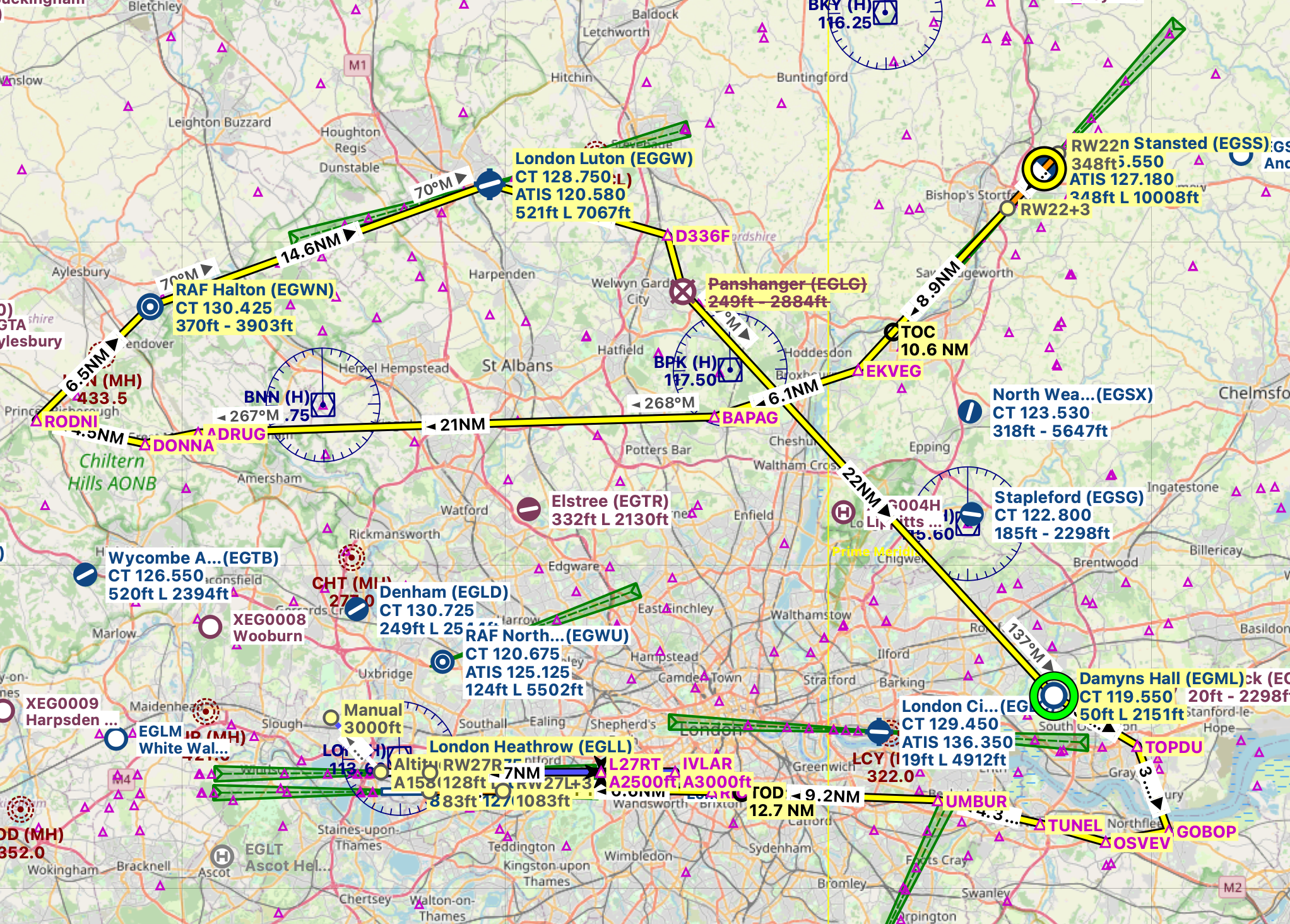
To prove the cheat works, here's a screenshot of the south east of England from Little Navmap from my iMac, with a
plan I entered into it (in yellow):
And here is a closer look at Heathrow airport:
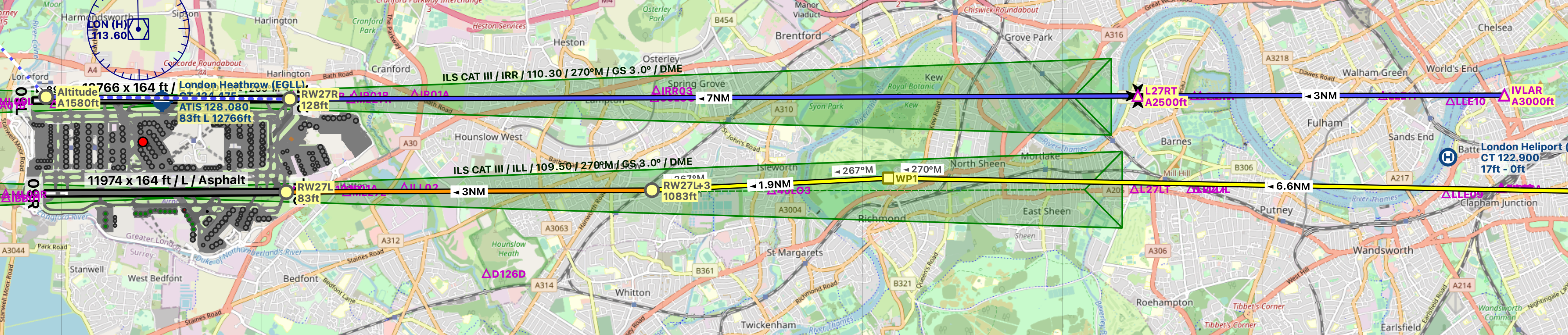
Everything is there! The ILS 'feathers' are shown in green, along with radio frequencies etc. Of course, on the PC
you can create a flight plan, save it, and then load it into MSFS; Xbox users can't do that, so you'll have to write
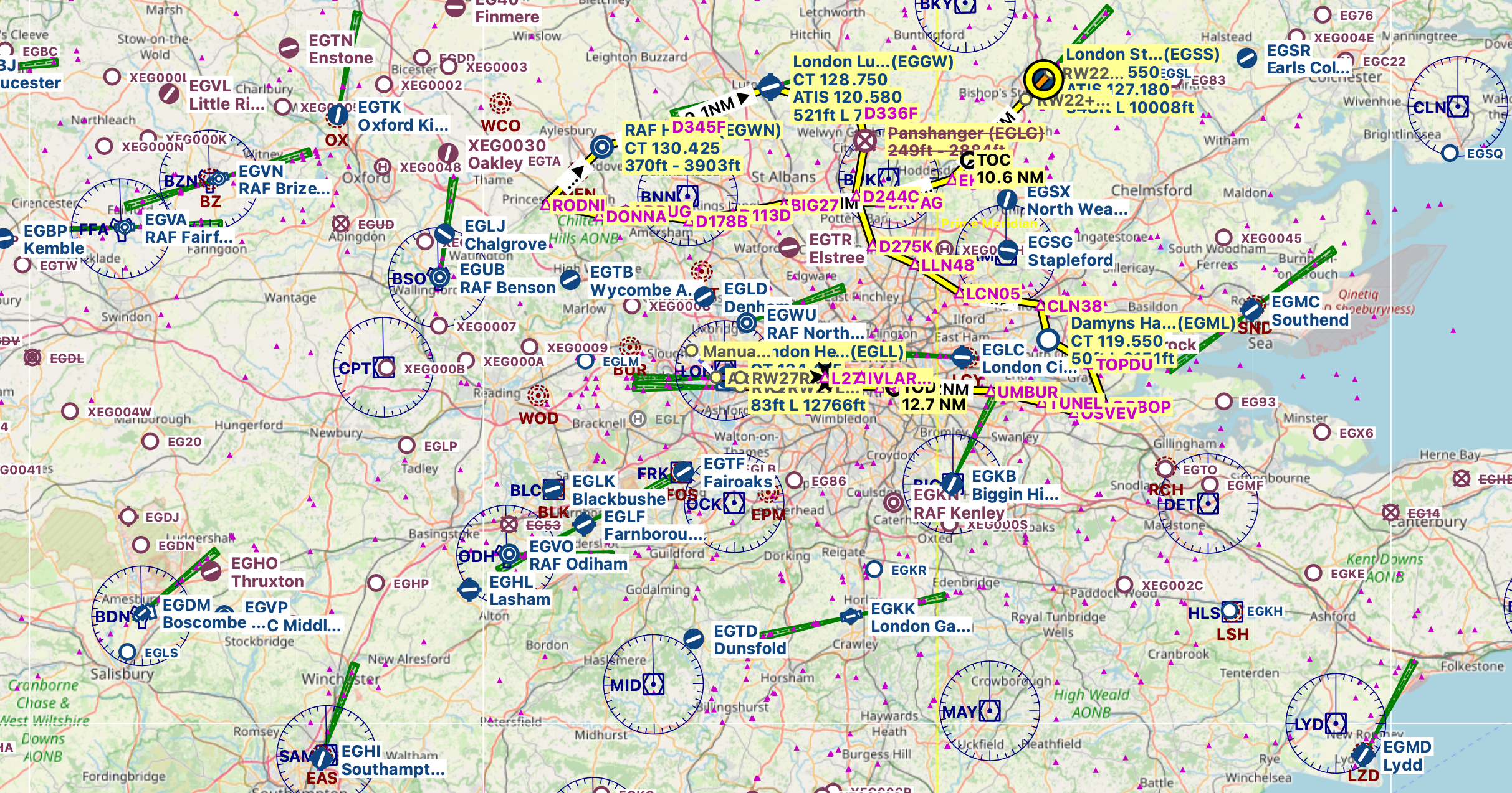
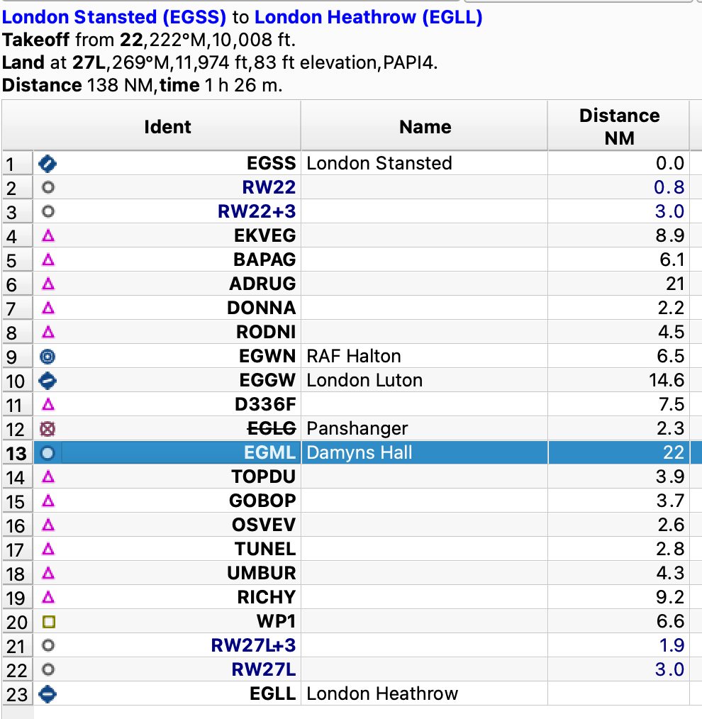
down the waypoints etc. This next image from Little Navmap shows what you'll need to take a note of, a flight from Stansted to Heathrow
via numerous waypoints:
This is how this rather fun little flight looks on Little Navmap: (Note: Panshanger, EGLG, is crossed through because it's no
longer an airfield, however its location still serves now as just a waypoint)